|
||
|
SAV increased in the mainstem Tidal Freshwater and Oligohaline segments of the James River in 2012. Here is a look at the location in the James River in 2011 and 2012. Slide the central bar left or right to compare the two dates. The black and white aerial photography was taken at an altitude of 12,000 ft. Left - Queens Creek on 08/03/12, Right - Queens Creek on 08/16/11 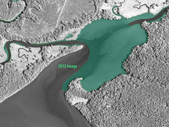 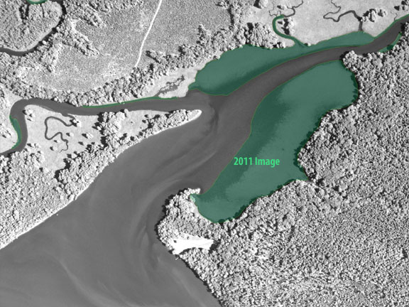 |